


Irishmore sud 9km

jeanmarcMasson
User GUIDE
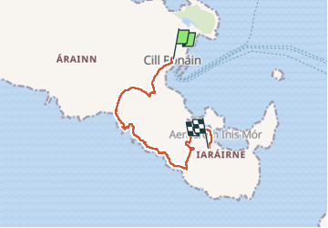

Length
8.9 km

Max alt
37 m

Uphill gradient
115 m
Km-Effort
10.4 km

Min alt
0 m

Downhill gradient
108 m
Boucle
No
Creation date :
2024-06-25 10:37:27.977
Updated on :
2024-06-25 14:35:22.648
2h32
Difficulty : Medium

FREE GPS app for hiking
 SityTrail
IGN / Geographical institutes
SityTrail Plus
The world is yours!
About
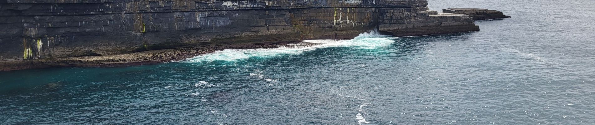
Trail Walking of 8.9 km to be discovered at Unknown, County Galway, Conamara Municipal District. This trail is proposed by jeanmarcMasson.
Photos

Positioning
Country:
Ireland
Region :
Unknown
Department/Province :
County Galway
Municipality :
Conamara Municipal District
Location:
Inishmore
Start:(Dec)
Start:(UTM)
455230 ; 5885869 (29U) N.
Comments